I lived in Montréal’s Sud-Ouest borough for six years.
During that time I watched neighbourhoods like Saint-Henri, Griffintown, and Pointe-Saint-Charles wrestle with the pressures of gentrification.
Yet one neighbourhood, despite being only a short walk from all three, remained surprisingly insulated from these changes. Côte-Saint-Paul is a quiet, residential pocket that feels almost like its own village. It is close to the heart of the city, but without the volatility, turnover, and growing pains that defined its neighbours.
In this article, I’ll explore what makes Côte-Saint-Paul unique. More specifically I will cover.
- Where is Côte-Saint-Paul located?
- What is the history of Côte-Saint-Paul?
- What is it like to live in Côte-Saint-Paul today?
- Côte-Saint-Paul demographics
- Côte-Saint-Paul commute
- Is Côte-Saint-Paul safe?
- What are the schools like in Côte-Saint-Paul?
- What is the Côte-Saint-Paul real-estate market like? (Q4 2025)
- Final thoughts
Where is Côte-Saint-Paul located?
Côte-Saint-Paul is a neighbourhood in Montreal, Quebec, Canada. It’s part of the Southwest Borough of the city. The neighbourhood is bordered by highway 15 and the Lachine Canal to the north, Canal de l’Aqueduc to the east and south and Boulavard Monk to the west.
What is the history of Côte-Saint-Paul?
The Island of Montréal was granted to the Sulpician Order by the King of France. In 1662 the Sulpicians created the farming concession that would become modern-day Côte-Saint-Paul. Rather than giving the entire area to a single owner, they divided it into long, narrow “côtes” (rural farming strips) and granted these lots to individual settler families to cultivate.
Around 1701 – 1710, the Sulpician Order started to create small mission chapels for the families living in living in the côtes southwest of Montréal. They dedicated the one at modern day Côte-Saint-Paul to Saint Paul the Apostle. This meant the mission was officially named after and placed under his spiritual protection of Saint Paul. As the mission grew into a parish, the surrounding rural settlement adopted the name Côte-Saint-Paul.
Side Note
1825 – The opening of the Lachine Canal
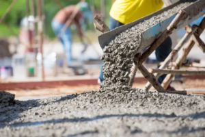
For nearly 150 years, Côte-Saint-Paul remained a quiet agricultural settlement. Its farming era ended abruptly in the mid-19th century when three forces converged: the opening of the Lachine Canal in 1825, the construction of the Aqueduct in 1853, and the arrival of the railway in 1850s. Together, these projects brought industry, workers, and infrastructure into the area, transforming the rural côte into an emerging industrial neighbourhood.
The opening of the Lachine Canal was the single biggest driver of change across the entire southwest. By allowing ships to bypass the dangerous Lachine Rapids, it triggered a wave of industrialization that attracted factories, mills, and thousands of labourers. The canal created both transportation routes and water power, making the region one of Canada’s early manufacturing hubs.
The Aqueduct, built soon afterwards, added essential water infrastructure to the area. It drew clean water from the St. Lawrence and carried it towards what is now the Atwater Pumping Station. This made large-scale urban settlement and industry safer and more viable in the area.
Finally, the arrival of the railways connected Côte-Saint-Paul to regional and national markets. Rail access accelerated factory growth and made the neighbourhood a strategic point for transport and logistics.
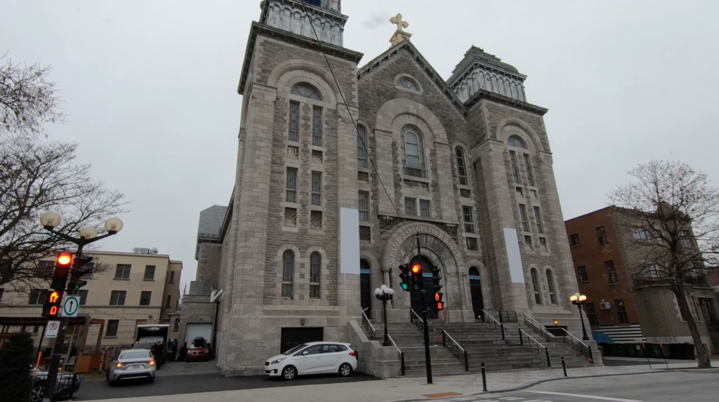
By the mid-1800s, the farmlands of Côte-Saint-Paul had been replaced by industrial buildings, rail lines, and dense rows of worker housing. During this period of time, the area also got its own parish church (Saint-Paul Church), town hall (Hôtel de ville de Côte-Saint-Paul), school and convent (Notre-Dame-du-Saint-Rosaire) and fire station. All of these buildings still stand today, and since 2007 the sector has been officially designated as a cultural heritage site by the City of Montréal.

1959 – The opening of the St. Lawrence Seaway
In 1959, the St. Lawrence Seaway opened a binational system of locks, canals, and deepened river channels stretching from Montréal to Lake Erie. The Seaway allowed large oceangoing ships to travel between the Atlantic Ocean and the Great Lakes, bypassing the shallow Lachine Canal entirely.
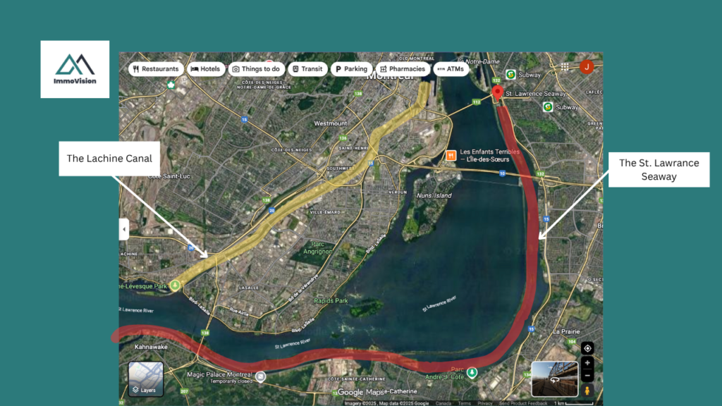
As a direct result of the St. Lawrence Seaway, most commercial shipping shifted away from the Lachine Canal after 1959. This caused a massive economic decline to all of the neighbourhoods that had formed along the banks of the Lachine Canal. Across Pointe-Saint-Charles, Little Burgundy, Saint-Henri, Ville-Émard and Côte-Saint-Paul, the number of factory workers collapsed from about 30,000 in 1951 to 18,000 in 1971, and then to just 8,000 in 1991, a loss of more than 70% of industrial jobs.
1960’s Urban Renewal
At the same time that Côte-Saint-Paul went into decline, cars were becoming widespread across North America. This mean that the middle class moved away from downtown Montreal and into the suburbs where there was more space. This created challenges for commuters aiming to get into the downtown Montreal for work since, the Island’s infrastructure had not been developed to connect the growing suburbs efficiently with the city’s core via car.
Urban planners saw areas like Côte-Saint-Paul as inner-city slums unfit for habitation. Influenced by the urban-renewal thinking of the era, Montréal set out to demolish entire working-class neighbourhoods, clear what planners labelled as “defective” housing, and replace them with large-scale infrastructure projects. This included highways, interchanges, and major arterials designed to move suburban commuters quickly into and out of the city centre.
In 1964, as part of this project, then mayor Jean Drapeau ordered the construction of the Décarie Expressway and the Turcot Interchange. The roads carved deep transportation corridors through the northern edge of Côte-Saint-Paul, demolishing blocks, severing historic streets, and isolating the neighbourhood behind highways and rail lines. The area remained standing, but it was physically and economically cut off from the rest of the Sud-Ouest.
What is it like to live in Côte-Saint-Paul today?
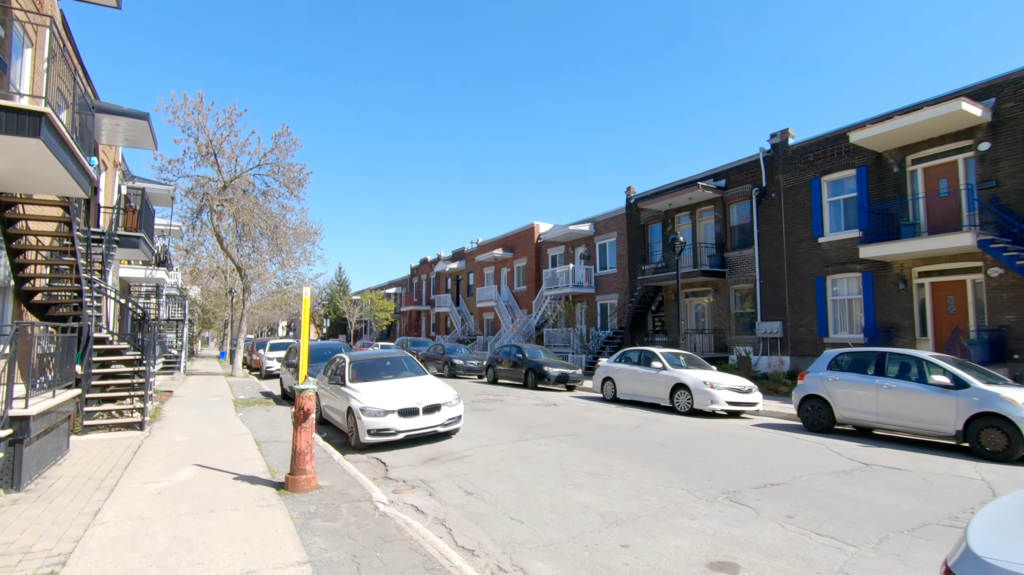
Today, Côte-Saint-Paul offers a compact, quiet and village-like residential pocket right in the heart of Montreal.
In 1978 the neighbourhood got it’s own metro line at Jolicoeur which helped reconnect the area to the rest of the city. As such, residents of Côte-Saint-Paul have very good access to downtown, walkable access to the Lachine Canal via Rue St. Patrick and Ville-Émard.
However, unlike other boroughs built along the Lachine Canal, Côte-Saint-Paul is much more residential. For instance, the area does not have a major commercial strip. Instead, it has only small, scattered commercial nodes along avenues like Rue de l’Église and Boulevard Monk. Moreover, since the area itself remains physically bounded by major highways and interchanges, this isolation has contributed to a calmer, more insulated neighbourhood character.

For instance, the data tells us that in 2016 more than half of residents (53 %) had remained at the same address for at least five years, and over a third of dwellings (38 %) were owner-occupied. By inner-city standards these are indicators of a stable resident base. For instance, areas like Griffintown or Saint-Henri have far higher resident turnover.
This is not to say that the neighbourhood has missed out on rising property prices and investment from the city. The City of Montreal has in fact put significant investment into Côte-Saint-Paul. For instance, the small plaza on Rue de Biencourt, beside Théâtre Paradoxe, was rebuilt by the City of Montréal and the Sud-Ouest borough. This is now pedestrian-focused public space.

Côte-Saint-Paul’s housing stock is typical of the Sud-Ouest and mirrors what you find in Saint-Henri, Pointe-Saint-Charles, Little Burgundy, and Ville-Émard. It is a mix of classic Montréal plexes, early 20th-century worker homes, and modest post-war apartment blocks. Unlike Griffintown which was almost completely cleared during the Urban Renewal era, Côte-Saint-Paul retained much of its village-like street grid and housing.
Côte-Saint-Paul does have community services, but not at the scale of its neighbours. Areas like Pointe-Saint-Charles, Little Burgundy, and Saint-Henri host far more social-service hubs and outreach centres due to their larger social-housing presence. Côte-Saint-Paul, on the other hand, has a quieter, more residential feel. It has fewer service institutions, less foot-traffic tied to those services, and a noticeably calmer street life.
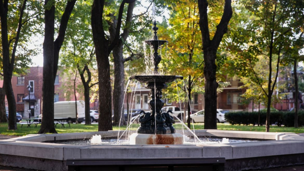
Côte-Saint-Paul has more green space than most people expect. The neighbourhood has 10 parks and access to the Lachine Canal which is ideal for walking, running, and cycling. Angrignon Park, one of Montréal’s largest parks, sits right next door, giving residents quick access to a lake, forest trails, and year-round outdoor activities.
Day-to-day life is quiet and practical. Small playgrounds are tucked into residential streets, and Monk Boulevard provides all the local cafés, bakeries, and shops you need. Overall, Côte-Saint-Paul isn’t a flashy destination, but a quite, stable neighbourhood with very good amenities, right in the heart of Montreal.
Côte-Saint-Paul demographics
Côte-Saint-Paul is a quiet, stable, working-to-middle class neighbourhood. According to the Ville de Montréal neighbourhood profile (2016), just over 53% of residents had lived at the same address for at least five years. This is unusually stable for an inner-city district and gives the neighbourhood a grounded, long-term community feel. The population skews mixed. There are about 14% are children, 58% are working-age adults, and 17% are seniors. This creates a balanced, multi-generational environment rather than a highly transient, youth-dominated one.
Economically, Côte-Saint-Paul reflects its historical roots as a modest working-class district. The average household income was $58,214 (2015), significantly lower than wealthier parts of the Sud-Ouest. Education levels follow the same pattern. Only 28% of adults hold a university degree, compared to 37% in the broader borough. Residents tend to work in practical sectors such as 28% in sales and service, 19% in business or administration. This fits the everyday, no-frills feeling of the area.
Culturally, the neighbourhood is strongly francophone, with the majority of households using French at home. The area also has meaningful diversity. Roughly 28% of residents are immigrants, and 25% are visible minorities (within the combined Côte-Saint-Paul and adjacent Ville-Émard). Housing is mainly low-rise duplexes, triplexes, and older apartments, with about 38% owner-occupied units. This indicates that the community is neither fully renter-dominated nor gentrified. All together, the demographics portray a neighbourhood that is more affordable, more stable and more family-friendly compared to other neighbourhoods in the same borough such as Saint-Henri or Griffintown.
Côte-Saint-Paul commute
In this section, we look at what it’s like to commute in Côte-Saint-Paul using the three main ways people get around:
Car
Driving in Côte-Saint-Paul is generally easier and less congested than in Saint-Henri or Griffintown. The neighbourhood is made up of quiet residential streets and with light local traffic, and on-street parking is usually manageable.
Where Côte-Saint-Paul stands out is road access. The neighbourhood sits directly beside the major road network for the southwest, giving you quick connections to:
- Highway 15 / Décarie (north–south connector toward NDG and the West Island)
- Highway 20 (toward Dorval, the airport, and downtown)
- De La Vérendrye Boulevard (east–west link through Côte-Saint-Paul and Ville-Émard)
- Atwater Avenue (northbound toward Westmount and downtown)
From Côte-Saint-Paul, you can reach Verdun, Ville-Émard, Saint-Henri, NDG, Little Burgundy, the MUHC (Glen) superhospital, and the city centre in minutes. Many residents also rely on Communauto, which has strong coverage in the area, making car-free living realistic for couples and small families.
Public transport (metro and bus)
Côte-Saint-Paul has good public transit, especially compared to other residential neighbourhoods in the southwest. The area is served by both the Monk metro station and Jolicoeur on the Green Line. Most homes are within a 10–15 minute walk from either station. This provides a direct, no-transfer ride into:
- Downtown Montréal
- Verdun
- Angrignon (for the shopping centre and bus terminal)
- Lasalle
- Central station (for national travel)
Residents can also easily get to Lionel-Groulx metro station where they can get the 747 bus directly to the airport.
The bus network is also a major strength. Frequent routes run along De La Vérendrye, Monk Boulevard, and Crawford, giving fast access to:
- Angrignon metro + bus terminal
- Verdun
- Saint-Henri
- Atwater Market
- MUHC (Glen) superhospital
- Westmount / Downtown
Bike
Côte-Saint-Paul is a good neighbourhood for cycling, especially with the long, scenic bike path that runs along the Lachine Canal on the district’s northern edge. This route is wide, separated from traffic, and perfect for commuting or recreational rides. From the canal path, cyclists can reach:
- Atwater Market (10–15 minutes)
- Old Port (10–15 minutes)
- Saint-Henri (10 minutes)
Inside Côte-Saint-Paul itself, cycling feels relaxed because the streets are flat and calm. There are multiple BIXI stations near Monk metro, local parks, and commercial areas. This makes short trips easy. Many residents bike most of the year because it’s often quicker than taking the car, especially when heading east toward Atwater, St-Henri, or the Old Port.
Is Côte-Saint-Paul safe?
According to SPVM data for Police Station 15, which covers Côte-Saint-Paul alongside Ville-Émard and parts of the Sud-Ouest, the neighbourhood records lower-than-average crime rates compared to more central districts. Côte-Saint-Paul typically sees around 32–36 crimes per 1,000 residents per year, placing it below the Montréal median and noticeably safer than higher-density, higher-turnover areas such as Saint-Henri, Little Burgundy, or Griffintown. Property crime is moderate, and crimes against the person remain relatively low for an inner-city neighbourhood. Over the past decade, crime in the station’s territory has declined steadily, reflecting broader improvements across the Sud-Ouest.
In practical terms, Côte-Saint-Paul feels like a quiet, residential, family-oriented neighbourhood. Because it has a more stable population, lower rental turnover, and fewer nightlife destinations, it doesn’t experience the same level of late-evening disorder you might find near the bars and metro stations of Saint-Henri. Most streets feel calm, particularly around the duplexes and triplexes near Parc Ignace-Bourget, the canal, and the small residential pockets east of Monk Boulevard. Daytime activity is modest, and the area is generally considered safe for walking, commuting, or raising a family.
That said, safety can vary by micro-area, as in any Montréal neighbourhood. The blocks closest to Monk metro and parts of Monk Boulevard can feel a bit busier and more chaotic, especially at night, due to higher foot traffic and the presence of social services in adjacent Ville-Émard. Some residents report occasional disturbances around commercial strips, but these are situational rather than systemic.
What are the schools like in Côte-Saint-Paul?
In Côte-Saint-Paul, there are two French-language primary schools, one French-language secondary school, no English-language primary schools, and three English-language secondary schools. School eligibility in Quebec is based on your home address, so the best way to confirm which schools your child can attend is to consult your local school board’s website.
Côte-Saint-Paul is primarily served by the French-language public school system under the school board Centre de services scolaire Marguerite-Bourgeoys (CSSMB), which operates most of the neighbourhood’s elementary schools and the local high school. The Centre de services scolaire de Montréal (CSSDM) also serves portions of the broader Sud-Ouest. Families who qualify for English-language education under Bill 101 fall under the English Montreal School Board (EMSB), though English-language schools are located in neighbouring districts such as Westmount, Little Burgundy, and Pointe-Saint-Charles.
Bill 101
– they have a parent who received the majority of their schooling in English in Canada and,
– that parent is a Canadian citizen,
– or the child already has a sibling who attended English public school in Canada.
What is the Côte-Saint-Paul real-estate market like? (Q4 2025)
| Metric | Côte-Saint-Paul | Regional (For Comparison) |
|---|---|---|
| Average Asking Price (All Properties) | $456,300 | $770,300 |
| Average Living Area | 899 sq ft | 1,200 sq ft |
| Days on Market | 50 days | 88 days |
Côte-Saint-Paul remains one of the most affordable corners of Le Sud-Ouest, with an average asking price around $456K, condos near $485K, and plexes typically trading in the mid- to high-$600Ks, all turning over faster than the regional average.
Final thoughts
Côte-Saint-Paul is one of those rare Montréal neighbourhoods that offers the best of both worlds. It is close to the city, well-connected, and surprisingly peaceful.
It’s more affordable than Saint-Henri or Griffintown, yet still benefits from the same proximity to the canal, parks, transit, and the broader Sud-Ouest lifestyle. What sets it apart is how insulated it feels. So far it has managed to avoid gentrification.
For anyone looking for a stable, down-to-earth neighbourhood with excellent access to the city, Côte-Saint-Paul is an underrated option worth considering.